Crossing over the Col du Grand-Saint-Bernard form Switzerland into Italy
On Sunday 11th September 2022 I started walking from the village of Bourg-Saint-Pierre in Switzerland up to the Col du Grand-Saint-Bernard on the Italian border. It was the first day of a two month pilgrimage of over 800 miles to Rome! I was so excited!
VIDEO..... David sharing his thoughts at the beginning of his journey to Rome!
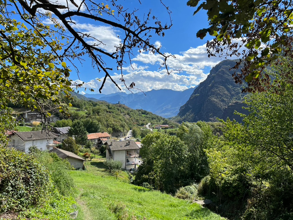
The first few days of my pilgrimage were through the Alps and its foothills down into the Aosta Valley. The scenery was truly magificent!
Slideshow . . . Ascent of Col du Grand-Saint-Bernard from Bourg-Saint-Pierre and descent to Etroubles
On Sunday 11th September 2022, after a relaxing day exploring the village of Bourg-Saint-Pierre, I set off on my journey to Rome!! On this first day of my Via Francigina Pilgrimage it was a 10.6 mile walk with an altitude gain of 1,050 metres (3,448 feet) up to the Col du Grand-Saint- Bernard at 2,473 metres (8,114 feet).
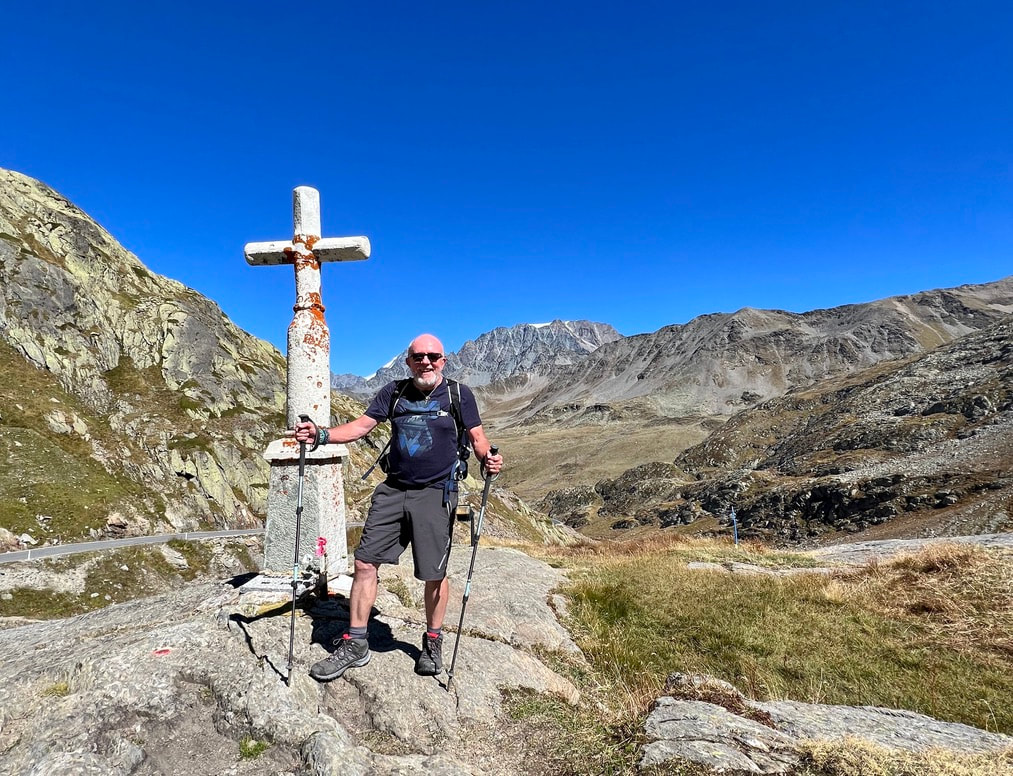
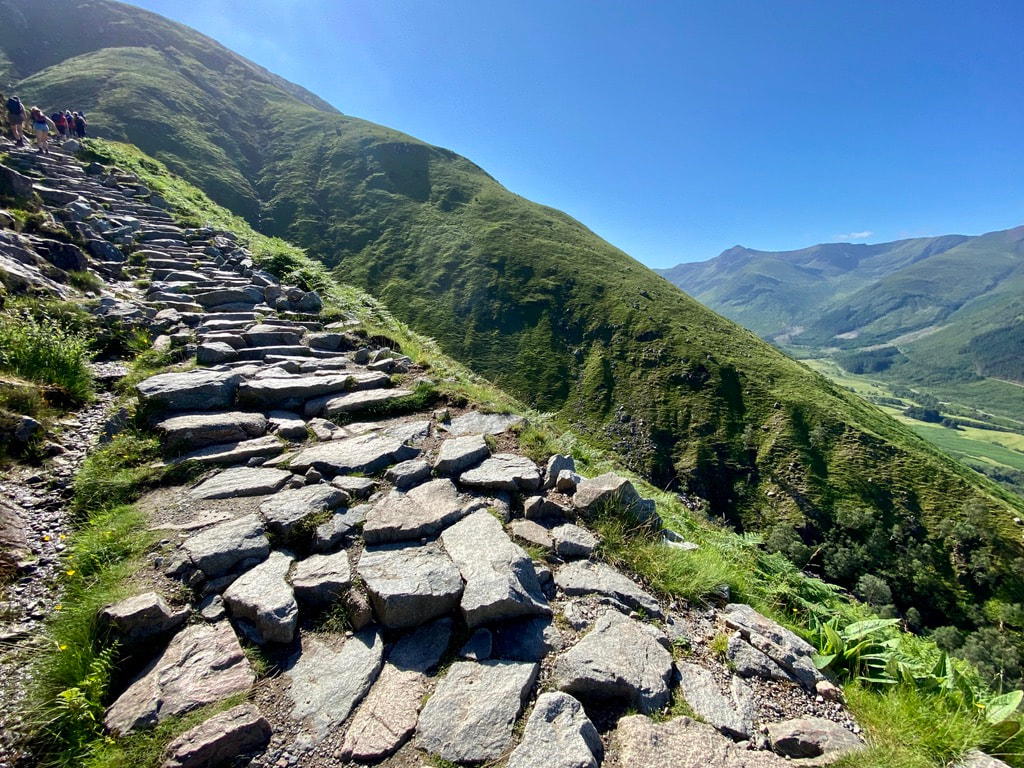
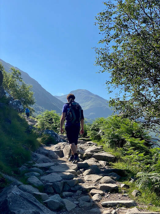
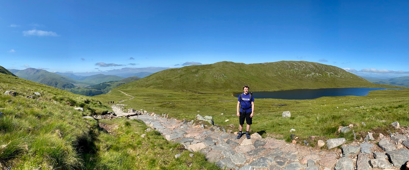
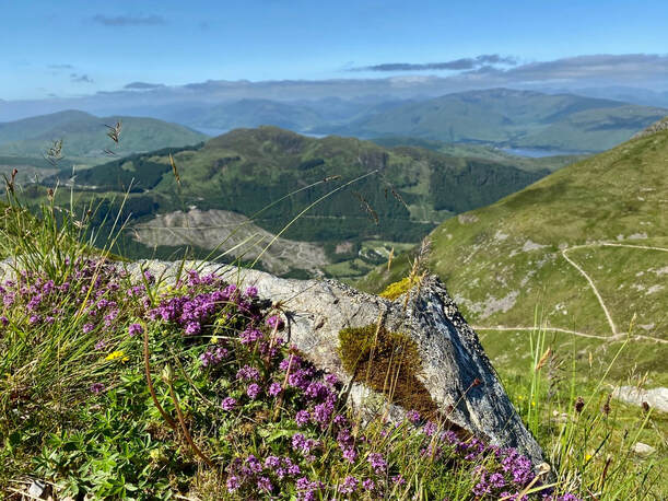
Journal entry . . . ' Sunday 11th September 2022 (Bourg Saint Pierre to Col du Grand-Saint-Bernard) The valley was deep in shadow as I walked through Bourg-Saint-Pierre. I was so excited! I called into the village church to pray for the adventure ahead. I was delighted to find a stamp for my pilgrim passport. It was a beautiful morning with a clear blue sky. I met Celine and her dog Pluto by the Lac des Toules . . . they were walking from Saas Fe with the Col du Grand-Saint-Bernard being their final destination. The steep and rocky trail, at times near the old GSB highway, wound its way higher and higher up to the pass . . . crossing streams that cascaded down the mountainside. I finally reached the pass at 2,473 metres. It was awesome to look over into Italy . . . ranges of rocky mountains as far as I could see with the Lake Great Saint Bernard below me. I could see the Hotel Italia on the far side of the lake where I am staying tonight. I was lucky to see some of the famous St Bernard dogs being taken out for a walk. At 6.15.pm I walked back up to the monastery on the pass for the evening Mass. As I walked back down the last rays of sunlight were catching the rocky mountain peaks back in Switzerland silhouetting the monastery.'
Journal entry . . . ' Sunday 11th September 2022 (Bourg Saint Pierre to Col du Grand-Saint-Bernard) The valley was deep in shadow as I walked through Bourg-Saint-Pierre. I was so excited! I called into the village church to pray for the adventure ahead. I was delighted to find a stamp for my pilgrim passport. It was a beautiful morning with a clear blue sky. I met Celine and her dog Pluto by the Lac des Toules . . . they were walking from Saas Fe with the Col du Grand-Saint-Bernard being their final destination. The steep and rocky trail, at times near the old GSB highway, wound its way higher and higher up to the pass . . . crossing streams that cascaded down the mountainside. I finally reached the pass at 2,473 metres. It was awesome to look over into Italy . . . ranges of rocky mountains as far as I could see with the Lake Great Saint Bernard below me. I could see the Hotel Italia on the far side of the lake where I am staying tonight. I was lucky to see some of the famous St Bernard dogs being taken out for a walk. At 6.15.pm I walked back up to the monastery on the pass for the evening Mass. As I walked back down the last rays of sunlight were catching the rocky mountain peaks back in Switzerland silhouetting the monastery.'
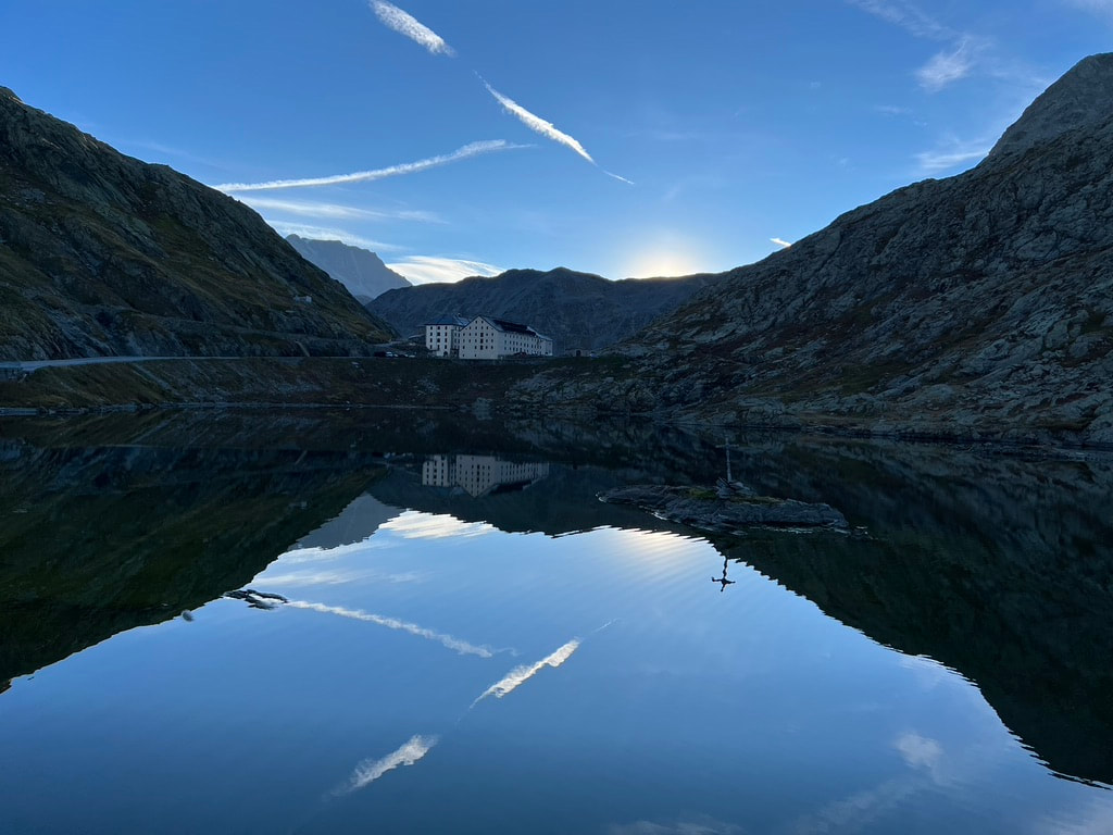
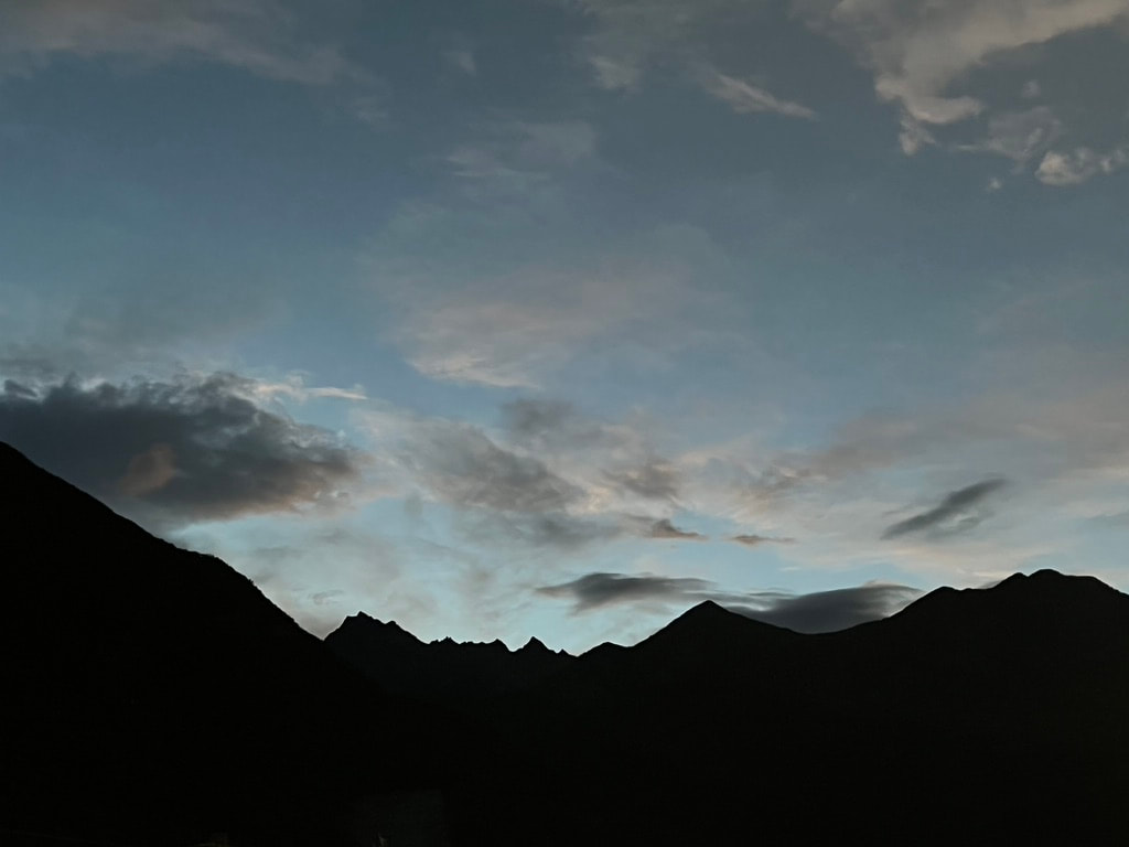
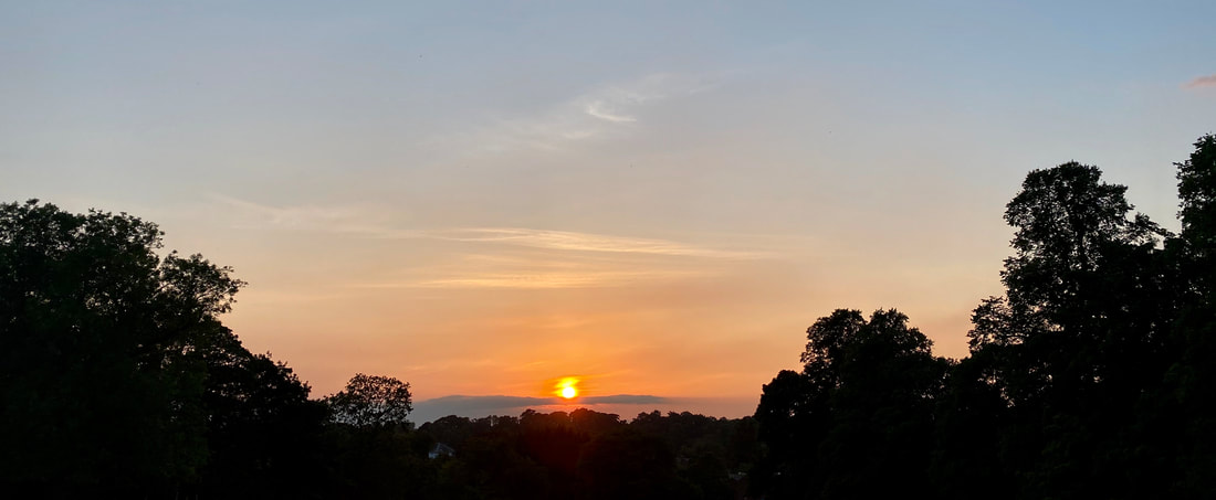
Sunrise at Lake Great St Bernard on the Col du Grand-Saint-Bernard
Journal entry . . . 'Monday 12th September 2022 (Col du Grand-Saint-Bernard to Etroubles). Today was a truly awesome day descending from the pass at 2,478 metres (8,129 feet) down to Etroubles at 1,274 metres (4,179 feet). The sunrise back over the Col du Grand-Saint-Bernard with perfect reflections in the lake was stunning. At the same time I took the sunrise photo I turned round to see the full moon just above the stone column and statue of Saint Bernard . . . absolutely awesome! What a start to my day!!
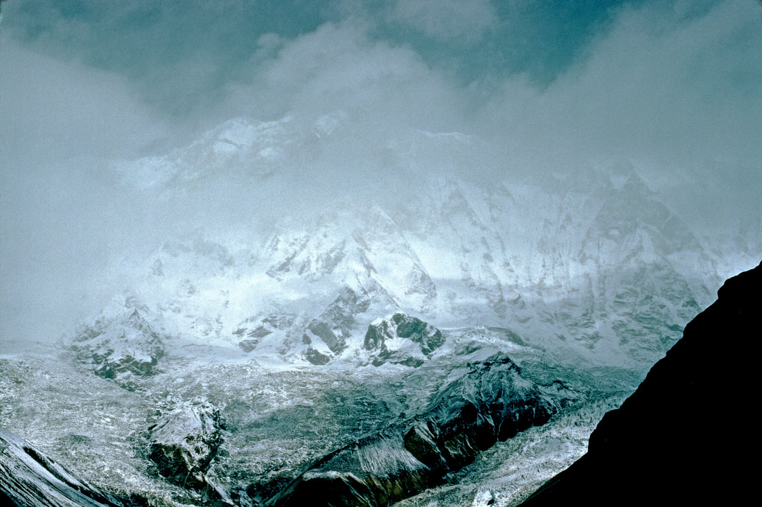
The walk down from the pass was breathtaking with incredible mountain vistas of sharp rocky granite peaks. As I descended with the sun rising behind me my long shadow danced before me over the rocks and boulders. This historic pass over the Alps is a jagged saddle between Mont Blanc in the west and Grand Combin in the east . . . with water flowing down to the Rhone Valley on the Swiss side . . . while all the streams on my descent into Italy drain down to the Po River . . . which I will cross in a couple of weeks time!
Descending to the pines of the tree line I met Ilona from Germany . . . she was on her way back up to the pass. We actually met yesterday on the Swiss side of the pass . . . we had both been observing the pretty pale-blue butterflies at the point where our paths met. Today we had a long chat about life, travel, walking and the sad death of the Queen a few days ago.
I soon came across the pretty village of Saint-Rhemy which over the centuries its inhabitants had been responsible for maintaining the road up to the Col du Grand-Saint-Bernard while providing horses and inns for travellers. I enjoyed a coffee in a cafe/bar where I was able to get another stamp for my pilgrim passport.
The VF track took me down through beautiful alpine scenery. At Saint-Leonard I met and chatted to Pascal and Rose-Marie form Martigney in Switzerland . . . they invited me to join them in their picnic lunch including grapes they had picked from a vineyard this morning! Amazingly the topic of the Himalayas came up in our chat. Pascal has been to the Himalayas 27 times and he has climbed several 7,000 metre peaks including Pumori!!'
Slideshow . . . My walk from Etroubles to Aosta on Day 5 of my Via Francigina Pilgrimage to Rome
Journal entry . . . 'Tuesday 13th September 2022 (Etroubles to Aosta) After an overnight stay in Etroubles, which in Roman times controlled the half-way point between the Col du Grand-Saint-Bernard and Aosta, I descended into the Aosta Valley . . . often following the Ru Neuf irrigation canal through woodland contouring the steep valley sides. Approaching Gignod I had a superb view to the north-east towards the mountain and glaciers of the Dent d'Herens at 4,171 metres (13,684 feet) plus the base of the Matterhorn whose main bulk was hidden in cloud. In Gignod I came across a beautifully carved sign pointing to my final destination in two months time . . . Rome!! I lit a candle for Lynne in the Church of Sant'Illiario in Gignod.
I arrived in Aosta in the mid afternoon so I had time to explore the awesome Roman sites. Amazingly my B+B was actually on the Roman bridge Ponte Romana! Today there is no water underneath as theTorrente Buthier has changed its course. As I walked into Aosta I came across the monumental Arch of Augustus built in 35 BC. I then walked through the Roman gate and walls of the Porta Pretoria. I explored the extensive site of the Roman Theatre . . . its southern facade still intact at a height of 22 metres (72 feet)! I also went underground into the incredible crypt of Criptoportico Forense with its Roman barrel vaults.
I still had time to go into the 11th century Cathedral of Santa Maria and the Romanesque/Gothic Church of Santi Pietro e Orso with its beautiful and peaceful cloisters'
Day 6 on the Via Francigina . . . Aosta to Chambave
Slideshow . . . day 6 on the Via Francigina . . . Aosta to Chambave
Journal entry . . . 'Wednesday 14th September 2022 (Aosta to Chambave) My day started on the Roman bridge where I met Caren and Kenric from San Francisco. We agreed that the Roman sites in Aosta were truly magnificent. The day started with rain and low cloud. Early on, for the first time on the VF, I lost the main trail. I ended up using my GPS map app to navigate my way out of a country park, with its many winding trails, above the outskirts of Aosta. I then realised I was much higher than the VF trail but I knew I was heading in the right direction following a path contouring an irrigation channel high up on the mountainside . . . it became exciting when the path finally disappeared and I only had the edge of the irrigation canal to walk on!!
Eventually I hit the main VF trail down at Quart Castle . . . probably an hour behind my intended schedule . . . all part of the adventure!
By the early afternoon brightness started to break through the base layer of heavy cloud revealing tantalising glimpses of the Alps. On the other side of the valley I could now see the large village of Saint-Marcel built on an alluvial fan . . . it took me back to my 'A Level' geography field-trip to Austria in 1970.
After 8 hours and 16.5 miles, up and down from Aosta, I finally arrived in Chambave. I must admit I feel a bit tired tonight.
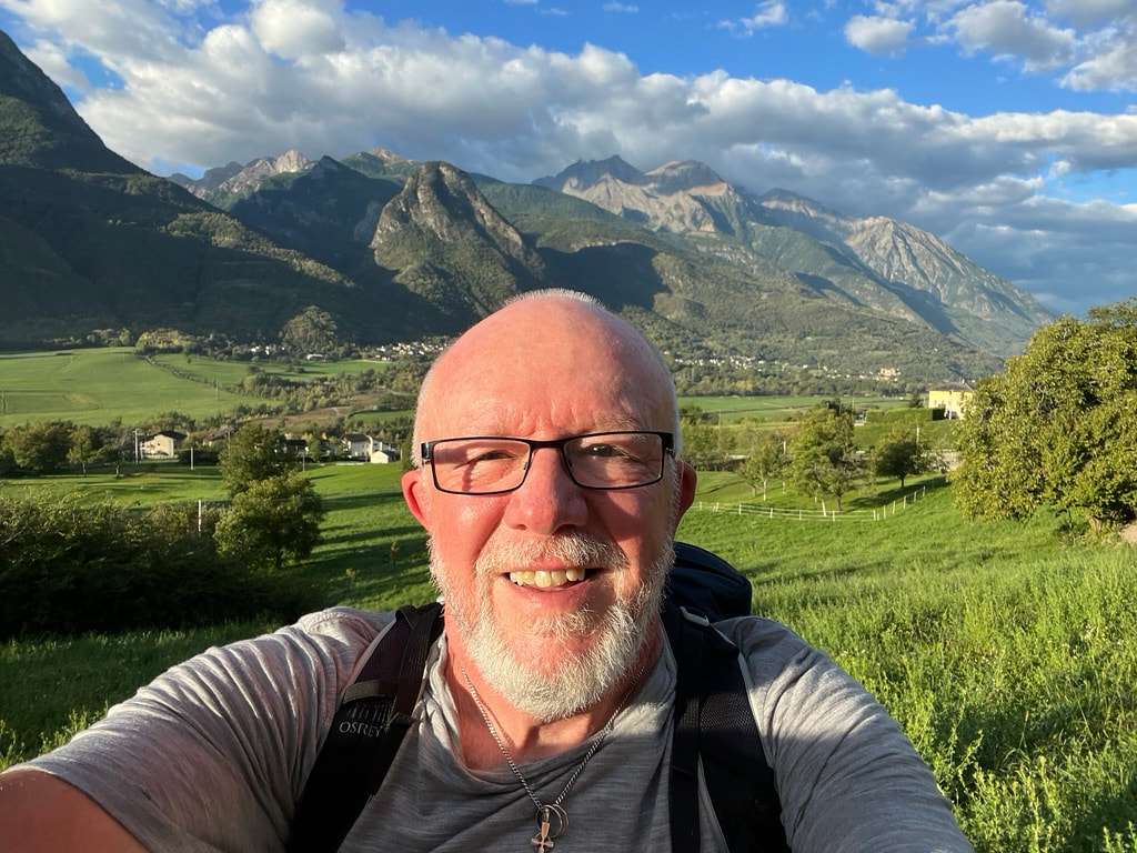
David leaving Chambave on Day 7 of the Via Francigina on the way to Verres
Slideshow . . . Day 7 on the Via Francigina . . . from Chambave to Verres
Journal entry . . . ' Thursdaty 15th September 2022 (Chambave to Verres) Today dawned bright and clear . . . a day of castles, gorges and fantastic views as I walked 19 miles in 10 hours!! It was quite hot walking in temperatures of 31C . . . today I drank 4 litres of water!! I eventually reached the village of Chandianaz where I came across Marcello outside his house which was covered in Via Francigina related art work . . . it was amazing! Not only is his house covered but also the stone walls around the hamlet. I wrote a message in his pilgrim guest book . . . I could see that Caren and Kenric had been there an hour before me. Marcello kindly gave me a pilgrim stamp.
Later I met Giancarlo who was walking in the other direction . . . he was on his way to Switzerland but not to the Col du Grand-saint-Barnard but by the lesser wel-known Little Saint Bernard Pass located between Savoie in France and the Aosta Valley . . . further to the west of the Via Francigina on the main alpine watershed.
On leaving one of the villages two thirds of the way to Verres I was shocked to come across Kenric and Caren. Caren was lying on the floor after a bad fall with facial injuries. Fortunately two locals were helping arrange for an ambulance to come from Aosta. I stayed for a few minutes but was satisfied everything was under control. I gave Kenric my 'Beyond the Sacred Mountains' contact card so he could give me an update on Caren's situation.
After Chatillon the VF trail contours a beautiful mountainside. The skyscape was absolutely stunning as I walked past the unusual limestone rock formations with trees and bushes on top. The trail led me past the 11th century Castle of Saint-Germain . . . dominating a narrow gorge the castle is located in one of the most strategic locations in the Aosta Valley . . . it is perched on a rocky outcrop high above the Dora Balthea valley. It was destroyed in 1661 in favour of the nearby Bard Fortess.
I eventually arrived in Verres, after 10 hours of walking, for my overnight stop. It was another 15 minute walk to the nearest pizzeria called 'Pako' for my evening meal. I was very tired but happy after a wonderful day on the Via Francigina. In the evening I received an email from Kenric. Caren was spending the night in hospital in Aosta under observation. They later spent a few days in Aosta to recover . . . I am delighted to say they were able to continue on their Via Francigina . . . but by this time I was about ten days ahead. I am also happy that we are now in contact via Facebook. It certainly made me realise how careful I have to be on the trail as a solo walker!'
The fading light of dusk as I walk back to my accomodation after my evening meal in Verres
I really hope you have enjoyed walking with me through the Alps on the first stage of my Via Francigina pilgrimage!! There are still a few days left in the alpine foothills before I eventually reach the flat plains of the Po River Valley with its huge agricultural landscapes of rice cultivation.
I would love to hear from you either by commenting directly to this blog or by secure email as outlined in the 'Contact' section of my website . . . 'Beyond the Sacred Mountains'.
"Jobs fill your pockets, but adventures fill your soul!" . . . Jaime Lyn Beatty
Regards
David
I would love to hear from you either by commenting directly to this blog or by secure email as outlined in the 'Contact' section of my website . . . 'Beyond the Sacred Mountains'.
"Jobs fill your pockets, but adventures fill your soul!" . . . Jaime Lyn Beatty
Regards
David


 RSS Feed